Marina Asset Mapping for Real Operations
Marina asset mapping lets you see the whole property at once: docks and fingers, slip inventory maps, utilities, pumpout points, safety gear, cameras, and patrol routes. For GIS Day week, turn that internal map into a simple, shareable view that helps staff make faster decisions and helps customers find what they need. Keep layers practical: dock letters, slip numbers, water and power runs, panel locations, pumpout stations, ladders, life rings, AEDs, spill kits, and emergency access. Marina asset mapping works best when every symbol answers a question your team gets every day.
Build a clean base and name layers in plain language. “A-Dock Slips,” “Power Pedestals,” “Pumpout & Washdown,” “Safety & AED,” “Service Zones,” and “Cameras (Generalized).” That way anyone can toggle what they need without training. Publish a staff-only view for internal details and a public view that hides sensitive items but still shows wayfinding. Mention GIS Day in your intro post and invite boaters to suggest one layer they’d like to see next.
Slip inventory maps that reduce friction
Slip inventory maps should make it obvious what is open now, what is reserved, and what has constraints (length, beam, power). Even a simple color ramp—green for open, amber for pending, red for taken—cuts calls and speeds up the counter. Add smart labels that show slip number, finger side, voltage/amp service, and nearest water spigot. When a spot flips from open to reserved, have your team change the status on the map as part of the booking flow. Slip inventory maps become the single source of truth when ops, service, and the office all edit the same layer.
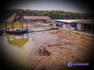
Use the same map to plan winter patrols and first-freeze checks. Mark shaded ramps, wind-fetch corners, and fingers that glaze early so your crew knows where to walk first after dark. That ties your GIS Day effort directly to safety and shows customers that marina asset mapping is not a gimmick—it’s how you run the property every day.
Public vs. staff views (privacy-first)
Create two versions of your map so marina asset mapping helps everyone without exposing sensitive details.
-
Staff view: full utilities, panel IDs, camera locations (general angles, not live feeds), keys for pump controls, and maintenance notes. Add edit rights for ops, service, and the office so slip status and work orders stay current.
-
Public view: wayfinding only—dock letters, slip inventory maps with availability bands, guest slips, restrooms, pumpout stations, life rings, AEDs, and parking. Omit boat names, phone numbers, access codes, and exact camera placements.
-
Data hygiene: standardize naming (“A-Dock 01–24 port/starboard”) and set validation so a slip can’t be “open” and “reserved” at once. When staff update a booking, the change should flip the color on your slip inventory maps automatically.
-
Safety overlays: frost-prone gangways, wind-fetch corners, and after-dark routes live on the staff view; post a simplified “use handrails” route on the public map during winter.
-
Version control: snapshot layers monthly so you can roll back mistakes and compare occupancy and utility issues across seasons—this is where marina asset mapping becomes a real operational record, not just a picture.
Simple GIS Day mini-campaign (3 posts + 1 poll)
Use the week to show, not tell, how marina asset mapping works—and to collect one concrete improvement request.
-
Mon (Geo Week kickoff): Post a clean screenshot of your public map. Caption: “Here’s how we use marina asset mapping for everyday decisions—docks, utilities, safety routes—plus slip inventory maps you can check at a glance.” Add a link to the public view.
-
Wed (GIS Day): Short reel or carousel: tap layers on, tap layers off (guest slips, pumpout, AEDs). Include one 10-second win: “Today, a boater found the closest 30-amp outlet in seconds.”
-
Fri (Engage): Poll with one question: “Which layer would help you most?” Options: guest slip highlights, after-hours wayfinding, winter safety routes, nearby services.
-
On-site tie-in: Print a single QR at the office: “Explore our slip inventory maps—see guest availability and amenities.”
-
Outcome: Close the week with one change based on the poll (e.g., add “After-Hours Route” to the public view). That proves the exercise mattered and keeps momentum for future updates to marina asset mapping.
Operational layers to add next season
Grow your marina asset mapping in ways that directly cut calls, shorten walks, and speed service:
-
Utilities by spec: voltage/amp at each pedestal, water spigots, hose bib shutoffs, panel IDs, GFCI trip history.
-
Maintenance zones: attenuators, wave walls, finger sections with age/condition, upcoming repair windows, “no-cart” planks.
-
Safety gear & routes: ladders, life rings, AEDs, spill kits, extinguishers, after-hours routes, first-freeze watch zones.
-
Customer experience: cart parking, load/unload zones, courtesy docks, kayak/SUP racks, restroom lines, ice machines.
-
Seasonal overlays: deicing bubble fields, winter gate closures, snow removal priority paths, work float staging.
-
Commerce layers: vendor access points, delivery windows, photo spots for events, partner pickup zones.
-
Analytics: heatmaps for incidents, pumpout usage, and slip turn. Pair this with your slip inventory maps so ops can see where constraints or upgrades will unlock capacity.
Keep the rule of three: add only the layers you can maintain, automate whenever possible (forms feeding a layer), and retire anything nobody uses.
One-page “map data standards” (drop-in for your ops binder) – Sample:
Use this short standard so marina asset mapping stays clean and your slip inventory maps remain the single source of truth.
Layer names (plain language):
-
“A–Dock Slips,” “Power Pedestals,” “Pumpout & Washdown,” “Safety & AED,” “Guest Slips,” “After-Hours Route.”
Attributes (required fields):
-
Slips:
dock,slip_number,side(port/starboard),length_max,beam_max,power(e.g., 30/50 A),status(open/pending/reserved),notes. -
Pedestals:
dock,position,voltage_amp,panel_id,last_gfci_trip,condition. -
Safety gear:
type(ladder/ring/AED/spill),location_desc,checked_date,status.
Status codes (enumerated):
-
Slips:
open,pending,reserved,out_of_service. -
Gear:
ok,needs_service,out_of_service.
Symbology & colors:
-
Slips: green=open, amber=pending, red=reserved, gray=out_of_service.
-
Safety gear: ladder=triangle, ring=circle, AED=diamond, spill=hex.
Editing workflow:
-
Office updates
statuswhen a reservation is taken → color flips instantly. -
Ops closes a slip or route for safety → add
out_of_servicewith a note and date. -
Service logs maintenance via a mobile form; required photo on
needs_service.
Privacy & publishing:
-
Staff view contains utilities, panel IDs, internal notes.
-
Public view omits PII, codes, and exact camera placements; show wayfinding + guest availability only.
Quality rules (weekly, 10 minutes):
-
Run a “missing data” filter (empty
power, blankstatus). -
Sort slips by
statusto spot mismatches with the booking system. -
Snapshot layers monthly so you can roll back or compare season over season.
Measurement and quick wins to show the team
Decide what success looks like for asset mapping before you post anything. Track three live numbers for the week: views of the public map, clicks on slip inventory maps, and one concrete operational save (for example, “guest slip assigned in under two minutes” or “pumpout found on first try”). Add one staff metric: edits made by ops or service that changed availability or fixed a data error. Capture a single screenshot of the public view and one of the staff view after an update, then file them with a one-paragraph note. Those artifacts become next year’s proof that the map is working, not just a picture.
Close Geo Week by announcing one visible improvement. Examples: a new “After-Hours Route” overlay, clearer colors on slip inventory maps, or a simplified guest slip label. Keep the change small and useful so you can maintain it. That pattern—measure, ship one improvement, tell people—builds trust and keeps marina mapping alive after the week ends.
CTA templates you can paste into email and social
Use short, specific copy so boaters know what the map can do for them right now.
-
Email subject: “Marina Asset Mapping: See Guest Slips and Essentials at a Glance”
Lead line: “We’ve updated our public map with dock letters, amenities, and slip inventory maps. Check guest availability and wayfinding before you arrive.” -
Social post (GIS Day): “Tap to see our marina asset mapping in action. Toggle layers for guest slips, pumpout, AEDs, and routes. Tell us which layer to add next.”
-
On-site QR caption: “Open our slip inventory maps on your phone. Find guest slips, power, water, and safety gear in seconds.”
-
Poll prompt: “Which new layer would help you most? Guest highlights, after-hours route, winter safety, or nearby services.”
Keep the link to the public view in your footer through winter and add a small “Map a problem?” line with a short form for corrections. That invites boaters to help you refine marina asset mapping and keeps slip inventory maps current without extra meetings.
Team training micro-drills (10 minutes, once a week)
Keep marina asset mapping useful with tiny, repeatable drills. Pick one scenario per week and let the on-duty team solve it using the staff view: “Assign a transient 30-amp slip for a 26-foot boat,” “Find the nearest AED to C-Dock,” “Close a slip and note why,” or “Update slip inventory maps after a same-day reservation.” Rotate who drives so office, ops, and service each practice editing. End with a two-minute recap: what was fast, what was confusing, and whether names or colors need to change. These micro-drills prevent stale data and build confidence that slip inventory maps are the single source of truth.
Wrap and next steps
Close Geo Week by scheduling a lightweight cadence so marina asset mapping keeps delivering value. Add a monthly ten-minute audit (missing fields, wrong colors, outdated notes) and a quarterly “ship one improvement” habit, like clearer guest labels or a simplified winter safety overlay. Keep the public link in your email footer and on the office QR sign, and invite corrections through a tiny form. Save this year’s screenshots, metrics, and poll result in a “GIS Day” folder so next fall you can start from proof, not memory. That’s how slip inventory maps evolve from a once-a-year demo into a daily tool your team and boaters trust.
*Sign up for our free newsletter “Marina Management Journal” so you can stay up to date
About MariCorp
Maricorp is one of the largest floating boat dock manufacturing and construction companies in the United States, specializing in galvanized steel floating docks and boat lift systems. With projects spanning coast-to-coast, Maricorp provides marina consultation and design, marine construction, marina repair and renovation, and boat dock disaster response and demolition.